Driving to Atlanta's Hartsfield–Jackson Airport: parking and terminals
6 min read
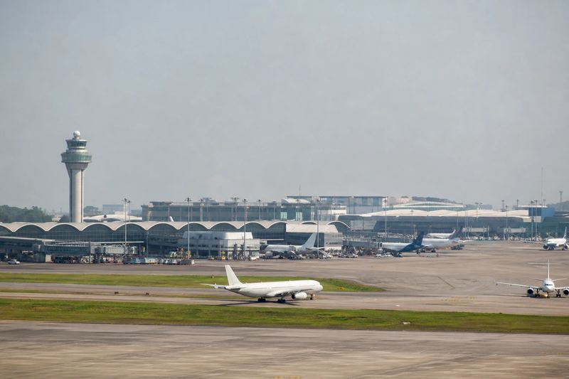
Hartsfield–Jackson Atlanta International Airport (ATL) sits about 11 miles by road from downtown Atlanta, GA — roughly 22 min of driving, or 8.1 miles in a straight line.
Hartsfield–Jackson is the airport a great many Americans have changed planes at without ever walking out of the building. Arriving by car is a different experience from connecting through it, and there is one thing worth knowing before you set off: the airport has two front doors, at opposite ends of a very long airfield, and they are not interchangeable.
Getting there by road
Two interstates do most of the work. I-85 runs along the northern edge of the airport, and I-285 — the Perimeter — passes to the south and west. Almost every approach ends up on one of them before following airport signs onto the terminal roads. From downtown, the route is south on the Downtown Connector, the combined I-75/I-85 trunk through the middle of the city, then onto I-85 for the last few miles.
The mileage from the center is small. The time is the variable, and the variable is the Connector. It is one of the most reliably congested stretches of urban interstate in the country, it carries local and long-distance traffic on the same lanes, and a single incident on it backs up everything behind. Drivers coming from the north and east of the metro often do better going around on I-285 than through the middle, even though it looks longer on a map.
Camp Creek Parkway serves the western side of the airport and the areas around it, and it is a useful alternative when the interstates are struggling.
Direction of travel changes the sensible route more than usual here. From the north side of the metro the choice is essentially through the middle or around the outside, and at peak times the outside wins. From the south and west, the airport is on your side of the city and the drive is short and easy. From the east, the Perimeter takes you round to the international end without touching the center at all — which is convenient, provided that is the end you want.
Terminals and how they are arranged
The Domestic Terminal is at the west end of the airfield. It is split into a North side and a South side, each with its own approach, curbside, check-in hall and parking deck. Which side you want depends on your airline, and the signs on the way in assume you already know.
The Maynard H. Jackson Jr. International Terminal sits at the east end, with an entirely separate road approach, its own garage and its own curb. It exists because the airfield is too long for one set of doors to serve it.
The concourses run in a line between the two ends and are lettered. Once you are through security they function as a single airport. On the road outside, they do not.
Moving between terminals
Inside security, the Plane Train runs the length of the concourses and is how everyone moves around. It is continuous, it is quick, and connections at Atlanta depend on it entirely.
Landside — that is, before security or after collecting bags — the two terminals are connected by a shuttle bus that goes the long way around the airfield. It works, but it is a proper journey. If you are being dropped off, or collecting someone, go straight to the correct terminal. The cost of getting it wrong here is much higher than at an airport built around a single loop road.
Parking
Decks sit close to the terminals for short stays. Daily and economy parking is further out, and remote lots connect by shuttle bus. The pricing follows the walking distance, as it does everywhere.
The complication specific to Atlanta is that parking is organized by terminal first — and on the domestic side, by North or South. Choosing the deck is really a consequence of choosing the terminal, so make that decision before you commit to a lane rather than while you are reading a sign at speed.
Rental cars are handled away from the terminals, at a facility reached by the airport’s own automated SkyTrain from the Domestic Terminal. That is efficient, but it is another leg. If you are returning a car before a flight, the sequence is drive, return, train, terminal, and each of those steps takes a few minutes it is easy not to count. Build the margin in rather than hoping.
Taking the train instead
MARTA rail reaches the airport, and the station is inside the Domestic Terminal rather than at the far end of a shuttle ride. That is rarer than it sounds and it removes the two unpredictable parts of driving in: the Connector and the parking. Trains run north through downtown toward Midtown and Buckhead.
Two caveats. The station serves the Domestic Terminal only, so an international arrival needs the inter-terminal shuttle first. And the train is only the better option if your starting point is near the line — for most of the suburbs, driving to a station and driving to the airport are much the same decision.
Driving in from further out
Atlanta is the default airport for a wide slice of the Southeast, which is why the long-stay lots are the size they are. Chattanooga, Birmingham, Greenville, Columbia, Augusta, Macon, Huntsville and Knoxville are all within a comfortable one-way drive, and for many travelers in those cities the drive plus a nonstop flight beats a shorter drive plus a connection.
If you are weighing that up, compare door to door rather than airport to airport: the drive here, plus parking, plus the walk and the Plane Train, against the alternative. The distance table below covers the driving half, and the airport guides and the distance calculator will handle the rest of the arithmetic. If you are also spending time in the city itself, the Atlanta page has distances from everywhere else.
Driving to ATL from nearby cities
Estimated road distances and drive times to the terminal area. Add your own margin for parking, the shuttle and check-in — these figures cover the drive only.
| From | Distance | Drive time |
|---|---|---|
| Atlanta, GA (downtown) | 11 mi | 22 min |
| Brookhaven, GA | 20 mi | 31 min |
| North Atlanta, GA | 20 mi | 32 min |
| Stonecrest, GA | 21 mi | 34 min |
| Smyrna, GA | 22 mi | 34 min |
| Sandy Springs, GA | 24 mi | 39 min |
| Dunwoody, GA | 27 mi | 42 min |
| Marietta, GA | 28 mi | 44 min |
| Peachtree Corners, GA | 32 mi | 50 min |
Every figure here is an estimated road distance, worked out the same way as the rest of the site — how the estimate works. Distances in kilometers: downtown Atlanta, GA is about 18 km away.