Driving in Phoenix, AZ: the freeway loops, the heat and the parking
8 min read
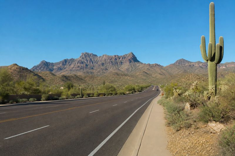
Phoenix is one of the most straightforward large American cities to drive in. The valley floor is flat, the arterial streets run on a mile-by-mile grid that hardly ever deviates, the freeways are recent and generously built, and there is somewhere to park at nearly every destination. There are no tolls anywhere in the state, so route planning is a question of time alone.
The difficulties here are not about roads. They are about the desert. Summer heat runs at a level that is genuinely hard on vehicles, the monsoon season brings dust storms that can erase visibility in minutes, and the same storms send water down washes that were bone dry an hour earlier. A driver who takes those three things seriously will find the rest of it easy.
What follows covers the freeway structure and the grid, the seasonal conditions that shape when you drive, where to leave the car, and then the districts and desert parks that reward parking once and walking.
The roads into Phoenix
The valley has two interstates and a set of state-route loops that do most of the local work.
I-10 runs east to west, arriving from California across the desert and continuing southeast toward Tucson. Through the center of Phoenix it passes below Margaret T. Hance Park in a short covered section, which is the closest thing the city has to a tunnel. I-17 runs north from I-10 as the Black Canyon Freeway, climbing out of the valley toward Flagstaff and the high country.
Around them sit the loops. Loop 101 makes a broad three-quarter ring through Glendale, north Phoenix, Scottsdale and the East Valley under three different local names. Loop 202 runs east along the Salt River and then south and west across the base of South Mountain. Loop 303 is the outer ring on the west side. US-60, the Superstition Freeway, carries traffic east through Tempe and Mesa, and State Route 51 runs north from downtown between the mountain preserves.
Underneath all of that is the grid. Arterial streets run roughly a mile apart in both directions, most of them with several lanes and a center turn lane, and they are numbered and named in a consistent pattern from the center of Phoenix outward. Even when a freeway stops moving, a parallel arterial is available and will get you there.
The grid has its own rhythm. Signal cycles on the big arterials are long, because they are timed for a lot of through traffic, so a missed light costs more waiting than it would in a denser city. Blocks are also long, which means a wrong turn takes a while to correct. On the other hand the streets are wide, the turn lanes are generous, and sightlines across flat open ground are as good as they get anywhere.
No tolls, and what that changes
Arizona has no toll roads. There are no gantries, no transponders, no plate billing, and nothing to arrange with a rental company. It is worth stating plainly because it removes a whole category of planning that visitors coming from Texas, Florida or the Northeast are used to doing.
The one thing worth reading is the carpool lane signage. The freeway HOV lanes here are restricted during posted peak hours only and are open to everyone at other times, which is unusual. They are separated by striping rather than a barrier, so entry and exit happen at marked openings.
Heat, dust and water
Summer here is the defining condition. For months, afternoon temperatures sit at a level that punishes tires, cooling systems and batteries, and a stationary car heats to a dangerous interior temperature very quickly. Before any long drive, check tire pressures and coolant. Carry more water than you think you need. Shade the windshield when you park, and never leave a person or an animal in a parked vehicle.
The summer monsoon brings the second hazard. Thunderstorm outflows can lift a wall of dust and push it across the desert, dropping visibility to nearly nothing within minutes. The state’s standing advice is to pull entirely off the roadway, stop, switch your lights off so following drivers do not aim at them, release the brake pedal and wait for it to pass. Trying to keep driving through it is how the multi-vehicle collisions happen.
The third is water. Washes that are dry all year can run fast and deep within minutes of rain falling upstream, sometimes many miles away and out of sight. Roads crossing them have barriers and depth markers for a reason. Driving into moving water of unknown depth is both dangerous and, under state law, something you can be billed for if you have to be rescued from it.
Where to leave the car
Parking is rarely a problem, which is a pleasant change from most cities this size. Downtown has garages and metered street parking, and the walkable districts around the valley have lots close by. Rates are moderate and availability is generally good outside major events.
The exception is trailhead parking. The lots at the popular mountain preserves are small relative to demand, and on a cool weekend morning they fill well before the crowds stop arriving. The residential streets nearby are restricted, so arriving early is the only real strategy.
The other exception is the winter and spring event calendar. Baseball spring training fills a scattered set of suburban ballparks through March, and the golf tournaments and the ballpark and arena downtown each concentrate a crowd into a small number of lots on their own schedule. None of it is difficult, but it changes the arithmetic on a specific afternoon.
Shade is its own consideration here in a way it is not elsewhere. A covered level in a garage or a space under a tree is worth walking an extra block for between May and October, because it changes how hot the car is when you come back to it.
Otherwise the sensible pattern is the one that works everywhere: pick a district, park once, walk it, and drive only between districts. Because the valley is so spread out, the distances between those districts are the part to plan around — you can use the distance calculator to see how the driving time between two of them actually adds up.
What is worth stopping for
Organized by where a single parking stop covers several things on foot.
Downtown Phoenix and Roosevelt Row
The central core is compact and improving. Heritage Square preserves a block of the original townsite, the science center sits beside it, and the ballpark and arena are both within a few blocks. Immediately north, Roosevelt Row is a walkable stretch of galleries, murals and converted bungalows. Along Central Avenue, the Phoenix Art Museum and the Heard Museum are close enough to combine on one visit, and the light rail links the whole corridor.
Papago Park
This is the strongest park-once stop in the metro area. The Desert Botanical Garden and the Phoenix Zoo sit side by side in a park of red sandstone buttes, with easy trails, a short walk up to the Hole-in-the-Rock formation and a view back across the valley. It is all served by its own parking and comfortably fills a day.
The mountain preserves
Phoenix has large desert preserves inside the city, which is unusual. South Mountain Park is one of the biggest municipal parks in the country, with a paved road climbing to Dobbins Lookout and a long network of trails below it. Camelback Mountain and Piestewa Peak, closer in, offer steep short climbs with the best views over the valley, and both have small lots that fill early.
Go at first light in the warm months. This is not caution for its own sake — the heat later in the day is a real hazard on an exposed desert trail.
Scottsdale, Tempe and Mesa
Old Town Scottsdale is walkable, with galleries, a historic core and a greenbelt path along the Arizona Canal. Tempe’s Mill Avenue runs down to Tempe Town Lake beside the Arizona State University campus, and the whole area is flat and easy on foot. Mesa’s downtown is quieter and has a strong arts center. Further out, Taliesin West sits against the northern foothills.
If you are flying in, the Phoenix Sky Harbor guide covers drive times from around the region; the airport is unusually close to downtown, which makes arrival easier here than in most large cities.
Using Phoenix as a base
Few big cities have better day trips. Sedona and the red rock country are about two hours north, Flagstaff and the pine forests a little beyond, and the Grand Canyon’s South Rim within a long day. Tucson and Saguaro National Park are a couple of hours southeast, and Prescott and Jerome sit in the mountains to the northwest. The Superstition Mountains and the Apache Trail begin at the eastern edge of the valley.
The table below lists what is reachable within four hours’ driving, with estimated distances and times, so you can judge a trip before building a day around it.
Within four hours' drive of Phoenix
Places you can reach in a single sitting, with estimated road distance and drive time. Pick any row for the full route, including the towns you would pass.
| Destination | Distance | Drive time |
|---|---|---|
| Buckeye, AZ | 36 mi | 58 min |
| San Tan Valley, AZ | 44 mi | 53 min |
| Lake Havasu City, AZ | 171 mi | 2 hr 51 min |
| Yuma, AZ | 181 mi | 3 hr 1 min |
| Casa Grande, AZ | 50 mi | 1 hr |
| Casas Adobes, AZ | 116 mi | 2 hr 19 min |
| Catalina Foothills, AZ | 121 mi | 2 hr 1 min |
| Tucson, AZ | 125 mi | 2 hr 5 min |
| Flagstaff, AZ | 143 mi | 2 hr 23 min |