Driving to George Bush Intercontinental: roads, tolls and parking
6 min read
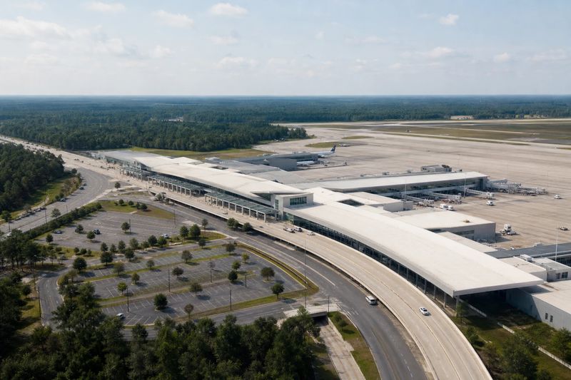
George Bush Intercontinental Airport (IAH) sits about 19 miles by road from downtown Houston, TX — roughly 30 min of driving, or 15.3 miles in a straight line.
Bush Intercontinental is a long way north of the city it serves, which makes the drive a proper leg of the journey rather than an afterthought. It is also a large site once you get there. Both of those facts argue for leaving earlier than the mileage suggests.
Getting there by road
Two freeways frame the airport. I-45, the North Freeway, runs up the western side; US 59 and I-69, the Eastex Freeway, run up the eastern side. Between them the Hardy Toll Road provides a third north-south route with a connector into the airport, and Beltway 8 — the Sam Houston Tollway — crosses the region south of the site and links everything together.
On the airport itself, JFK Boulevard is the main approach from the south and Will Clayton Parkway comes in from the east and west. Which combination you use is mostly decided by which part of the metro area you are starting from.
The road network is good. The traffic on it is the problem. Both freeways carry heavy commuter loads, the northbound evening peak is long, and construction is a permanent feature of a region that keeps growing outward. Because the trip is a genuine twenty-odd miles rather than a short hop, congestion does not just add a few minutes — it can add most of the trip time again.
Tolls
The tolled roads around the airport are electronic. Nothing stops at a booth; traffic passes under a gantry and the charge is read from a transponder or from the plate. That is convenient in your own car and potentially expensive in a rental, because rental companies typically add a fee for each toll they process. It is worth asking about at the counter.
The terminals
Terminals here are lettered rather than numbered, running from A through E, and they are spread along the site rather than gathered around a single frontage. International flights are concentrated at the eastern end.
For a driver, that means the terminal letter is the piece of information you need before you reach the airport. The entrance roads are signed by letter, the system is largely one-way, and correcting a wrong turn is a lap rather than a U-turn. Sort it out before you leave, not on the approach road.
Curbside at each terminal is split by level, departures above and arrivals below, and getting the level wrong costs about as much as getting the letter wrong. There is a designated waiting area for drivers meeting an arriving passenger, which is a much better plan than circling a site this large while a phone stays silent.
Getting between terminals
Automated trains connect the terminals, one on the secure side for passengers who have already cleared security and one on the public side for anyone who has not. They exist because the distances are too great to walk, which is the useful thing to understand about the scale of the place.
If your journey involves a terminal change, or if you are meeting someone arriving at a different terminal from the one you drove to, budget real time for the connection. This is not an airport where everything is a few minutes from everything else.
Parking
There is garage parking next to the terminals and cheaper long-stay parking further out, connected by shuttle buses. The trade-off is familiar: closer costs more and saves you a bus ride at each end.
For a short trip, the terminal garages are easy to justify. For a week or more, the outer lots are the sensible answer and the shuttle is a minor cost. What matters either way is deciding in advance, because this is a big site with several entrances and the signage is written for people who already know where they are going.
No train, and what that means
Bush Intercontinental has no rail link. METRO operates a bus service between downtown Houston and the airport, and it is a real option if your schedule fits it, but there is nothing here equivalent to a light rail line running to the terminal.
The practical consequence is that almost everyone arrives by road, either in their own car or in someone else’s. That is why the parking is on the scale it is, and it is another argument for treating the drive as the part of the trip most likely to go wrong. If you are also driving around the city, the guide to driving in Houston covers the freeway loops, the tolls and the parking.
Houston’s other airport, Hobby, is much closer to downtown and much simpler to drive into. When there is a genuine choice of flights, that is worth weighing.
Driving in from further out
The airport draws from a wide area of southeast Texas and beyond. Beaumont and the eastern edge of the state come in on I-10 and US 59. College Station and the Brazos Valley come down SR 6 and US 290. Austin and San Antonio are both within a single comfortable drive, and people make those trips when a specific flight justifies it rather than as a matter of course.
Rain is the wildcard on all of these. Houston gets downpours heavy enough to put standing water across freeway lanes quickly, and the traffic effect is out of proportion to the weather itself. For the alternatives elsewhere in the country, the other airport guides cover the same ground.
Driving to IAH from nearby cities
Estimated road distances and drive times to the terminal area. Add your own margin for parking, the shuttle and check-in — these figures cover the drive only.
| From | Distance | Drive time |
|---|---|---|
| Houston, TX (downtown) | 19 mi | 30 min |
| Spring, TX | 11 mi | 22 min |
| Atascocita, TX | 13 mi | 27 min |
| The Woodlands, TX | 20 mi | 32 min |
| Cypress, TX | 26 mi | 41 min |
| Pasadena, TX | 27 mi | 42 min |
| Conroe, TX | 29 mi | 46 min |
| Alief, TX | 30 mi | 47 min |
| Baytown, TX | 34 mi | 54 min |
Every figure here is an estimated road distance, worked out the same way as the rest of the site — how the estimate works. Distances in kilometers: downtown Houston, TX is about 30 km away.