Driving in Austin, TX: the traffic, the tolls and where to park
8 min read
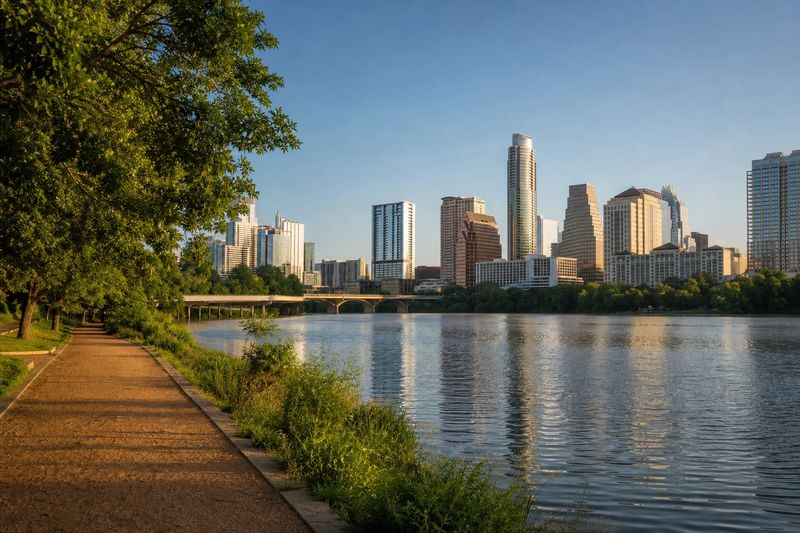
Austin is harder to drive in than a city of its size ought to be. It grew faster than its roads for two decades, it never got a complete outer loop, and the Colorado River cuts straight through the middle with only a handful of bridges over it. All of that traffic ends up concentrated onto very few routes, and the main freeway through the center is congested for a large part of the day rather than only at the peaks.
None of it is technically difficult driving. The freeways are ordinary, the signage is fine, and the street grid downtown is regular and easy to read. It is just slow, and the slowness is structural rather than incidental, so no clever route finding fixes it.
The good news is that the parts of Austin most visitors want are clustered together in a small area, and the parts that need a car are genuinely worth the drive. The Hill Country starts immediately west of the city limits, and the roads out into it are among the best in Texas.
The roads into Austin
I-35 is the spine and the problem. It runs the length of the state through the middle of the city, carrying long-distance freight, regional traffic between San Antonio and Dallas, and Austin’s own local trips all in the same lanes. Through the center it splits into stacked upper and lower decks, which makes exits awkward and leaves nowhere to add capacity. Treat it as a road to be crossed rather than used.
MoPac Expressway runs parallel a few miles west and takes a good share of the north–south load, with variable-priced express lanes down the middle. US 183 curves around the northern and eastern sides. SH 71 crosses east to west on the southern side, linking the airport to the western suburbs. Loop 360, the western hill road, is technically an arterial rather than a freeway and is discussed further down, because it is worth driving for its own sake.
The river crossings
This is the thing that shapes traffic here more than any single freeway. The Colorado River widens into a lake through the center of the city, and there are only a small number of bridges across it in the central area. Every one of them funnels traffic, and closures for events or maintenance on any of them are felt immediately on all the others.
If you are moving between the northern and southern halves of the city at a peak, choose your crossing before you set off rather than at the last moment.
Tolls
The toll roads around Austin are all electronic. Traffic passes under a gantry at normal speed and the charge is read from a transponder mounted on the windshield, or billed to the registered owner from a photograph of the license plate at a higher rate. There are no booths and no cash lanes.
The network includes a northern route out toward the fast-growing suburbs, a southern connector serving the airport corridor, the managed lanes on the western expressway, and — most usefully — a long bypass running well east of the city. That eastern bypass exists precisely to let through traffic skip Austin, and part of it carries the highest posted speed limit anywhere in the United States.
For a driver heading between San Antonio and the Dallas area with no business in Austin, the eastern bypass is almost always the right choice at any busy hour. It adds distance and subtracts a great deal of stopped time.
In a rental car, settle the toll question at the counter. The per-charge administrative fee rental companies apply is routinely larger than the toll, and this is a region where you can accumulate several charges without noticing.
Weather and the hills
Two conditions matter. West of the city the land rises into limestone hills, and the roads there are narrow, winding and often shoulderless, with sharp crests that hide oncoming traffic. They are enjoyable to drive and unforgiving of inattention.
The same geology creates the second problem. Rain running off thin soil over rock arrives in the creeks fast, and low water crossings that are dry most of the year can become impassable within minutes of a storm upstream. Crossings are signed and some carry depth gauges. The local rule is not to drive into moving water at all, and since storms here pass quickly, waiting is cheap.
Where to leave the car
Downtown is small. You can walk across the whole central business district in about twenty minutes, and the Capitol grounds, the museum blocks, the university edge and the lakefront trail are all inside that circle or just outside it. Park in a garage, once, and walk the rest.
Street parking downtown is metered, time-limited and enforced, and the residential streets immediately behind the commercial blocks are permit zones. The Capitol complex has visitor parking of its own, which is often the most convenient stop if the Capitol and the museums are your first destinations.
South of the river, the main commercial strip has a mix of small lots and metered street parking that fills up in the evening. The large park west of downtown has its own lots, and they fill early on warm weekends — this is the one place in Austin where arriving before mid-morning genuinely changes the day.
There is also a light rail line and a network of park-and-ride lots on the edges of the city, which are worth considering if you are staying out in the suburbs and spending a day in the center. They will not get you into the Hill Country, but they will get you downtown without paying to store a car all day.
Out in the hills, the trailheads and swimming holes have small parking areas that fill fast, and some of the more popular preserves manage access by advance reservation rather than first-come. Check before you drive out, because there is nowhere else to leave a car.
What is worth stopping for
Organized by where one parking stop earns you a day on foot.
The Capitol and downtown
The Texas Capitol sits at the head of the main avenue with grounds open to walk through, and the building itself is open to visitors. Downhill from it, Congress Avenue runs south to the river, with the historic entertainment street crossing it a few blocks up.
Within the same walk: the state history museum just north of the Capitol, the university’s art museum a little further on, and the bridge at the southern end of the avenue where a very large colony of bats roosts under the deck and emerges at dusk from spring through autumn. The hike-and-bike trail loops both banks of the lake from there, and it is the single best thing to do in Austin on foot.
East of I-35
The neighborhoods immediately east of the freeway were cut off from the center when it was built, and they have changed a great deal since. They are flat, gridded and easy to park in compared with anywhere west of the freeway, which makes them a reasonable base for an evening if downtown parking looks unappealing. Walking between them and downtown means crossing the freeway on one of a limited number of bridges, so pick your crossing point rather than assuming one is nearby.
The university
The campus immediately north and east of the Capitol is worth walking through, with a landmark tower at its center and a presidential library at its eastern edge. On autumn Saturdays the stadium fills and the surrounding streets become impassable, which is either a reason to visit or a reason to be elsewhere.
South of the river
The commercial strip running south from the bridge is the most walkable few blocks outside downtown. West of it, the large park along the creek holds a spring-fed pool that stays cold all year, a botanical garden and a sculpture garden, all within one parking stop, with a greenbelt trail running upstream into the hills from the western end.
The hills
Loop 360 runs through the hills on the western side, crossing a lake on a high steel arch bridge with a view down the water in both directions. A short, steep walk up a hill north of it gives the best overview of the city and the lake. Beyond that the roads climb into ranch country, and the reservoirs west of town have public access points along their shores.
Using Austin as a base
The car pays for itself on the way out. San Antonio is a short run southwest. The Hill Country west and north delivers two-lane roads, granite domes, small towns with German settlement history and a string of swimming holes. Houston is a comfortable half day east, the Gulf coast is reachable in a long day, and the pine forests begin northeast. The other driving guides cover several of those cities in the same detail.
The table below lists everything within four hours’ driving, with estimated distances and times, so you can weigh a trip before you commit the day to it.
Within four hours' drive of Austin
Places you can reach in a single sitting, with estimated road distance and drive time. Pick any row for the full route, including the towns you would pass.
| Destination | Distance | Drive time |
|---|---|---|
| New Braunfels, TX | 52 mi | 1 hr 3 min |
| Killeen, TX | 68 mi | 1 hr 22 min |
| San Antonio, TX | 85 mi | 1 hr 42 min |
| College Station, TX | 102 mi | 2 hr 2 min |
| Waco, TX | 111 mi | 2 hr 13 min |
| Victoria, TX | 128 mi | 2 hr 8 min |
| The Woodlands, TX | 156 mi | 2 hr 36 min |
| Spring, TX | 162 mi | 2 hr 42 min |
| Houston, TX | 170 mi | 2 hr 50 min |
| Mansfield, TX | 189 mi | 3 hr 9 min |