Driving to Los Angeles International: the horseshoe and parking
6 min read
Los Angeles International Airport (LAX) sits about 16 miles by road from downtown Los Angeles, CA — roughly 26 min of driving, or 12.1 miles in a straight line.
LAX is not a difficult airport to find. It is a difficult airport to arrive at. The freeways get you close quickly and then hand you over to a one-way loop road that every terminal faces onto, and that loop is where the time goes. Everything about driving here is really about the last mile.
Getting there by road
The approach is from the east. A freeway spur ends near the airport and feeds the main east–west boulevard that leads into the central terminal area, and the north–south freeway a little further inland is the trunk route from the rest of the basin. A surface boulevard runs underneath the runways for traffic passing north to south, which is worth knowing about when the main approach is jammed.
The mileage from downtown is unremarkable. The time is entirely a function of when you travel. Los Angeles does not have two sharp rush hours so much as a long congested middle of the day with worse patches at either end, and the roads feeding the airport carry both airport traffic and ordinary commuting on the same lanes.
Coming from the north on the coast side, or from the South Bay, is generally easier than crossing the basin. The driving in Los Angeles guide covers the wider freeway network and the timing that goes with it.
The horseshoe
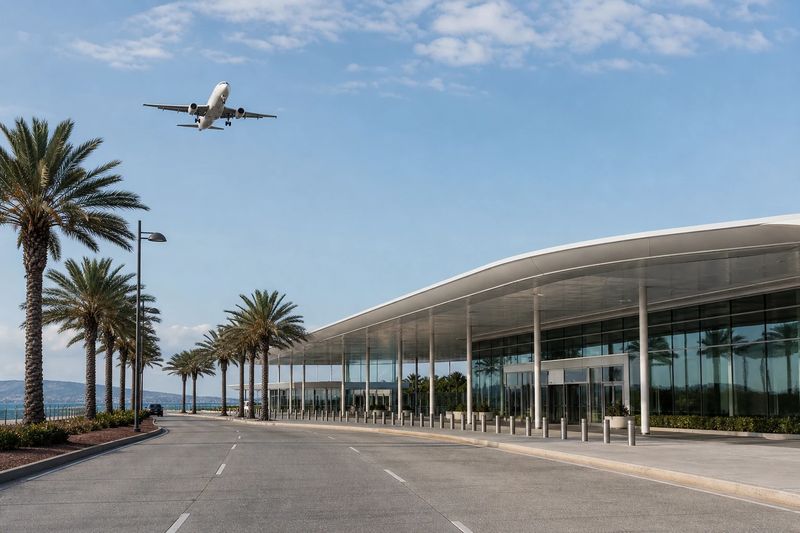
The central terminal area is a two-level loop road, universally called the horseshoe. Upper level for departures, lower level for arrivals. The terminals face inward onto it, numbered, with the international terminal among them.
Three things follow from that design:
- It is one-way. Miss your terminal, or pick the wrong level, and the correction is a full lap. At a busy hour that lap can cost you fifteen minutes or more.
- Signage is by terminal number, not by airline. Know your terminal before you enter, and confirm it on your booking rather than from memory, since airlines do relocate.
- The loop is the bottleneck, not the freeway. Traffic entering, stopping and pulling out at every curbside in a confined space is what makes the last mile slow.
There has also been long-running construction on the eastern side of the airport, which has altered approach roads, parking access and pickup points more than once. Do not assume the layout you remember from a previous trip still holds.
Moving between terminals
Some terminals connect behind security. Others do not. Between adjacent buildings the sidewalk inside the horseshoe is often the quickest route, and walking usually beats waiting for a shuttle bus around a congested loop.
If your connection involves two terminals that are not linked inside security, treat it as a proper transfer: out, along, and back through screening. That is a real amount of time and it is the mistake people make when they book a short connection here.
Drop-off and pickup
Both happen on the horseshoe, departures above and arrivals below, and both are busy for the obvious reason that every terminal shares the same confined loop. If you are collecting someone, the sensible approach is to wait somewhere off the loop until they actually have their bags in hand, then make one pass. Circling is how people end up spending twenty minutes on a quarter-mile of road.
Parking
Structures sit inside the horseshoe, directly opposite the terminals, and cheaper economy parking sits outside the central area with a shuttle bus connection.
The close-in option has a hidden cost that does not exist at most airports: to reach a central structure you have to drive the horseshoe, and to leave you have to drive it again. On a bad afternoon the traffic can consume more time than the walk it saves. If you are leaving the car for more than a couple of days, the outer lots are the better trade.
Rental cars have long been collected and returned away from the central terminal area, with company shuttle buses covering the connection. That makes a rental return a three-stage operation before a flight: the drive to the lot, the return, then the bus into the horseshoe. It is the part of a Los Angeles departure that people underbudget most consistently. As with the pickup arrangements, the details here have been in flux while construction proceeds, so confirm where you are actually going rather than trusting a previous trip.
Taking transit instead
Rail runs near the airport rather than into the middle of it, with a shuttle covering the last part, and the construction on the east side has been reworking that link. Check the current arrangement before you depend on it.
For someone staying in central Los Angeles without a car, the combination avoids both the freeway and the horseshoe, and that is the honest argument for it — not speed, but the removal of the two least predictable parts of the trip.
Driving in from further out
LAX pulls travelers from the whole of Southern California and beyond, largely because of the nonstops that smaller airports in the region do not have. San Diego, Santa Barbara, Bakersfield, Palm Springs and the Inland Empire are all routine one-way drives, and people drive in from Las Vegas and Phoenix as well.
The honest comparison, if a closer airport also serves your route, is door to door: this drive plus the horseshoe plus parking, against a much easier drive to Burbank, Long Beach, Santa Ana or Ontario. The distance table below covers the first half, and the distance calculator will do the rest.
Driving to LAX from nearby cities
Estimated road distances and drive times to the terminal area. Add your own margin for parking, the shuttle and check-in — these figures cover the drive only.
| From | Distance | Drive time |
|---|---|---|
| Los Angeles, CA (downtown) | 16 mi | 26 min |
| Inglewood, CA | 5 mi | 9 min |
| Hawthorne, CA | 5 mi | 10 min |
| Redondo Beach, CA | 9 mi | 18 min |
| Gardena, CA | 9 mi | 18 min |
| Santa Monica, CA | 10 mi | 19 min |
| Torrance, CA | 11 mi | 23 min |
| Florence-Graham, CA | 13 mi | 26 min |
| Carson, CA | 14 mi | 29 min |
Every figure here is an estimated road distance, worked out the same way as the rest of the site — how the estimate works. Distances in kilometers: downtown Los Angeles, CA is about 26 km away.