Driving in San Diego, CA: the freeways and the parking problem
8 min read
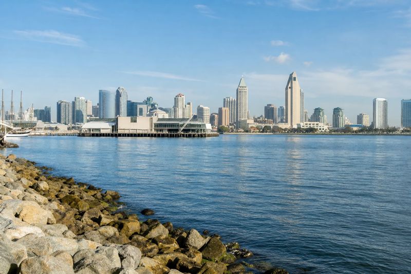
San Diego drives better than its reputation and parks worse. The freeway network is broad, well built and legible, traffic volumes are noticeably lighter than in Los Angeles, and for most of the day you can cross the region at speed. Then you arrive somewhere near the ocean on a warm Saturday and spend forty minutes discovering that everybody else had the same idea.
The other thing to understand is the terrain. San Diego is built on a series of mesas separated by steep canyons, and the street network reflects that. Roads that look continuous on a map stop at the edge of a ravine and pick up again on the far side, so the direct route between two points a mile apart can involve a three-mile detour. This is why local drivers navigate by freeway even for short trips, and why an unfamiliar visitor should trust the freeway over the apparent shortcut.
Beyond that, the region is simply large. It runs sixty miles up the coast and a long way inland, and the places worth seeing are spread across all of it.
The roads into San Diego
I-5 is the main artery, running the length of the coast from the border crossings in the south, through downtown and up past the northern beach towns toward Orange County and Los Angeles. I-805 runs parallel to it a few miles inland for much of the city, splitting off in the south and rejoining in the north, and it is often the faster of the two.
I-8 is the east–west route, starting near the ocean and climbing inland through the valleys toward the mountains and the desert. I-15 heads northeast toward the inland suburbs and eventually Las Vegas. Between them, a set of state routes fills in the gaps: one runs through a canyon in the middle of the city as a mid-century parkway with no truck traffic, another crosses the bay on a long curved bridge, and several serve the northern and eastern suburbs.
If you learn one thing about this network, learn where I-5 and I-805 rejoin in the north. That junction is the region’s most dependable traffic jam, in both directions, twice a day.
The coast road
There is an alternative to the freeway for the northern beach towns. The old coastal highway runs parallel to I-5 through a string of small communities north of the city, close enough to the water to see it for long stretches. It has traffic lights, cyclists and a lower speed limit, so it is slower than the freeway by a considerable margin.
It is also much better. If you are heading up the coast with an afternoon rather than an appointment, take the coast road one way and the freeway back. The freeway is the right choice in a rush and the wrong choice on a day off.
Tolls and express lanes
Tolling here is limited and entirely electronic. A toll expressway runs through the eastern part of the South Bay, and several freeways carry variable-priced express lanes running alongside the free lanes, with the price changing according to demand. There are no booths: charges are read from a transponder mounted in the windshield, or billed against the license plate.
In a rental car, ask at the counter how tolls are handled and whether a transponder is fitted. The per-charge administrative fee that rental companies add is routinely larger than the toll itself, and a week of casual express-lane use can turn into a surprising line on the final bill.
Traffic patterns and the border
The commuter peaks run roughly seven to nine in the morning and four to six thirty in the afternoon, concentrated on the inland corridors and the approaches to the northern employment areas. Beach traffic is a separate rhythm entirely: outbound toward the water on summer weekend mornings, and back inland in the late afternoon.
The border crossings at the southern end of the region add their own pattern. Northbound waits are long and unpredictable, and the queues can affect the freeway approaches. Driving into Mexico is possible but requires planning — most rental agreements prohibit it, and US auto insurance does not extend across the line, so separate Mexican coverage is needed. Many people park on the US side and walk across.
Fog and heat
The marine layer sits over the coastal strip through late spring and early summer, and it can be genuinely thick within a mile of the water while the inland valleys are bright and clear. It typically lifts around midday. On the cliff roads and the coastal highway that matters, because visibility falls off quickly.
Inland is the opposite problem. Cross the first ridge going east and the temperature climbs sharply, and the climb over the mountains toward the desert is long enough to be hard on a laboring engine in summer.
Where to leave the car
Downtown is the easy case. Garages are plentiful and, by the standards of large American cities, reasonably priced, and the central district is compact enough that one stop covers the waterfront, the historic quarter and the ballpark district on foot.
Balboa Park is the second obvious park-once base. The museums line a single pedestrian axis, so one lot puts nearly all of them within a ten-minute walk. The central lots fill first on good weekends; the ones a little further out generally do not.
The beaches are the hard case. Lots at the popular strands fill early, and the residential streets behind them are heavily permit-restricted and actively enforced. There are two workable strategies and no third one: arrive before mid-morning, or accept that you will walk. The same applies to the cliffside village in the north and to the island across the bay.
If you are staying centrally and heading out for a day, the distance calculator is worth a look before you decide whether a given beach is close enough to be worth the parking gamble.
What is worth stopping for
Organized by where a single parking stop earns you a day on foot.
Balboa Park
A large formal park on a mesa above downtown, laid out for two early-twentieth-century expositions and left with an extraordinary collection of Spanish colonial revival buildings. Most now hold museums — art, natural history, aerospace, photography, model railroading — strung along a central promenade with gardens, a botanical building and an outdoor organ pavilion between them. The zoo occupies the northern end.
This is the single best use of one parking stop in the city. You could spend two days here without moving the car.
Downtown and the bay
The historic quarter downtown is a preserved district of Victorian commercial buildings, and the waterfront a few blocks west runs along the working bay. Moored along it are an aircraft carrier turned museum and a collection of historic sailing ships, with the ferry to the island leaving from the same stretch. All of it connects on foot.
Old Town
Northwest of downtown, at the foot of the valley where the first Spanish settlement stood, a state historic park preserves a block of adobe and early wooden buildings around a plaza. It has its own parking and a trolley stop, and the mission that gave the city its name sits further up the same valley — close enough to combine, but a separate drive rather than a walk.
Coronado
The island across the bay is reached either by a long curved bridge from the south of downtown or by a passenger ferry from the waterfront. Once there, the main street, the beach and the late-Victorian seafront architecture are all within a walk of one another, and the beach itself is one of the widest in southern California.
The bridge is worth driving once for the view on the way over. On a summer weekend the ferry is often the better plan, because parking on the island is as tight as anywhere else on the coast.
Point Loma
The peninsula that closes off the bay ends in a national monument at the site of an early Spanish landing, with a preserved lighthouse, tide pools below and a view back across the harbor to the city. It is a drive out and a drive back, but the walking at the end justifies it. The cliffs on the ocean side of the peninsula are a separate stop and worth the detour at the end of the day.
The northern coast
The cliff road north of the city runs above the ocean and drops into a village built around a small cove, where sea lions haul out on the rocks in plain view. Further north, a state reserve protects a stretch of eroded sandstone bluffs and a rare pine forest, with trails running down to the beach. Parking at both is tight; both are much better on a weekday.
Using San Diego as a base
The region rewards a car most on the way out of it. Los Angeles and its main airport are a straightforward run north. The desert parks are a couple of hours inland over a mountain pass, and a cluster of mountain towns sits between the two at elevation, cool in summer and occasionally snowy in winter. The Orange County beaches are close enough for an afternoon, and the wine country in the inland north is closer still.
The table below lists everything within four hours’ driving, with estimated distances and times, so you can see what each of those trips actually costs.
Within four hours' drive of San Diego
Places you can reach in a single sitting, with estimated road distance and drive time. Pick any row for the full route, including the towns you would pass.
| Destination | Distance | Drive time |
|---|---|---|
| San Marcos, CA | 36 mi | 57 min |
| Carlsbad, CA | 40 mi | 1 hr 2 min |
| Temecula, CA | 62 mi | 1 hr 15 min |
| San Clemente, CA | 64 mi | 1 hr 17 min |
| Aliso Viejo, CA | 78 mi | 1 hr 33 min |
| Mission Viejo, CA | 79 mi | 1 hr 34 min |
| Hemet, CA | 84 mi | 1 hr 40 min |
| Irvine, CA | 88 mi | 1 hr 46 min |
| Newport Beach, CA | 89 mi | 1 hr 46 min |
| Costa Mesa, CA | 90 mi | 1 hr 48 min |