Driving in Dallas, TX: the toll roads and where to leave the car
8 min read
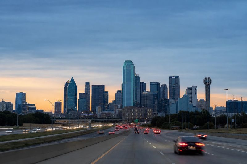
Dallas is one of the easier large American cities to drive in and one of the harder ones to walk around. The freeways are wide, fast, numerous and well signed. Nothing about the driving itself is technically demanding. What defines the experience is scale: the Dallas–Fort Worth metro spreads across an enormous amount of ground, and almost everything you might want to do involves a real drive to get there.
The second defining feature is tolling. North Texas has built a substantial network of toll roads, mostly running north through the fast-growing suburbs, and all of it is electronic. There are no booths to stop at and no way to pay cash, which is convenient if you have a transponder and mildly expensive if you are in a rental car and nobody explained the system to you.
Get those two things straight — plan by driving time, and decide in advance how you are handling tolls — and the rest of the region opens up easily.
The roads into Dallas
Downtown sits inside a ring of freeways, and every major route into the region ends up touching it.
I-35E runs north and south through the western side of the center, heading north toward Denton and Oklahoma and south toward Waco and Austin. I-30 crosses east to west, linking Dallas to Fort Worth on one side and running out toward Arkansas on the other. I-45 starts downtown and runs southeast to Houston. US 75, known locally as Central Expressway, carries the northern commute out toward the suburbs, and I-635 — the LBJ Freeway — forms the northern loop around the city.
Two interchanges are worth knowing by name. The High Five, where Central Expressway meets the LBJ Freeway, stacks ramps five levels deep and is genuinely impressive to drive through. The tangle west of downtown where I-30 and I-35E cross is the other, and it is the one that backs up. In both cases the decision about which lane you need happens earlier than you would expect.
How the tolls work
The regional network includes several major tolled routes: a north–south tollway running from downtown into the northern suburbs, a long orbital turnpike swinging around the northern and eastern edges of the metro, and a fast east–west route across the northern suburbs. There are also variable-priced express lanes built into the middle of several free freeways, separated by barriers and entered at marked points.
All of it is electronic. Traffic passes under a gantry at speed and the charge is read from a transponder on the windshield. Without one, cameras photograph the license plate and a bill is mailed to the registered owner at a higher rate.
For a visitor in a rental, this is the one thing to sort out at the counter. Ask whether a transponder is fitted and what the company charges to process a toll. The administrative fee per individual charge is frequently larger than the toll, so a few casual trips up the tollway can produce a bill out of all proportion to the distance.
Whether to pay them
Most tolled routes here run parallel to something free, so avoidance is technically possible. Whether it is sensible depends on direction. Going north into the suburbs during a peak, the free alternative is usually an arterial with a traffic light every half mile, and the toll buys back real time. Crossing the region east to west, the free freeways are perfectly adequate.
When the traffic builds
The peaks run roughly seven to nine in the morning and four to six thirty in the afternoon, with the northern corridors carrying the heaviest load. Because the metro has several distinct employment centers rather than one, the flow is not a simple in-and-out pattern: the reverse direction is frequently busy too, and there is no single quiet lane heading against the tide.
The choke points are consistent. The freeway ring around downtown backs up at both peaks, the interchange west of the center is slow in the afternoon, and the corridor out toward the airport is heavy whenever a wave of flights is departing. Friday afternoons are the worst few hours of the week across the whole network.
Park-and-ride as a strategy
The light rail system here is better than the region’s reputation suggests. It reaches downtown, the airport and a long list of suburbs, and most outer stations have large free lots attached. If you are staying in a suburb and spending a day downtown, leaving the car at a station and riding in is often faster than driving, and it removes the parking question entirely. A commuter line also runs west to Fort Worth from downtown, which makes that day trip possible without touching a freeway.
Weather worth planning around
North Texas gets ice, not snow, and ice is the worse of the two. Freezing rain glazes bridges and elevated ramps first, and this region has a great many of them. When an ice event is forecast the metro effectively closes for a day or two. The events are short, so waiting is almost always better than driving.
Spring brings the other hazard. The area sits in an active severe-storm corridor, and hail large enough to damage bodywork is a routine part of March through May. If you have a choice between an open lot and a covered garage during storm season, take the garage.
Where to leave the car
Downtown Dallas is generously supplied with garages and surface lots at prices that are moderate compared with older cities, and the central district is compact enough that one stop covers a lot of ground. Park once and walk.
The freeway ring around downtown means the garages are easy to reach from any direction, and signage from the ring into the center is good. Street parking is metered and enforced, and circling for it wastes more time than it saves.
Outside the center, most districts have either their own garage or plentiful street parking, because they were built with cars in mind. The exceptions are the two or three walkable nightlife districts near downtown, where evening parking gets tight and a nearby garage plus a ten-minute walk is the practical answer. Large event venues have their own lots.
What is worth stopping for
Organized by where one parking stop earns a day on foot.
Downtown
The western edge of downtown holds the plaza and the former warehouse where the assassination of President Kennedy took place, now a museum occupying the floor from which the shots were fired. It is the most visited site in the city and handled with more restraint than you might expect.
A short walk northeast, a cluster of major cultural buildings sits along a few blocks: an art museum with a strong collection, a sculpture center with an outdoor garden, an Asian art museum, and two performance halls by well-known architects. Beyond them, a park built on a deck over the sunken freeway connects downtown to the district north of it — a genuinely good piece of urban repair, and pleasant to sit in.
An observation tower on the western side of downtown gives you the geography of the whole metro in one look, which is useful early in a visit.
East and south of the center
The warehouse district immediately east of downtown is the city’s live music quarter, best in the evening and easy to park near. Southeast of the center, a large park holds one of the finest collections of art deco exhibition architecture anywhere, built for a 1936 exposition and still hosting the state fair each autumn. It has enormous lots.
South across the river, the older neighborhoods on the higher ground include a compact commercial strip that has become one of the more walkable few blocks in the city.
North of downtown
The district immediately north of the deck park is dense, walkable and served by a heritage streetcar line running along its main avenue, which makes it an easy place to leave the car for the evening. Further northeast, a large lake ringed by a trail sits inside the city limits, with a botanical garden on its eastern shore.
Fort Worth, as a park-once day
Fort Worth is close enough to treat as part of the same trip and different enough to be worth a whole day. It also happens to concentrate almost everything worth seeing into two districts, each of which works as a single parking stop.
North of its center, a preserved stockyards quarter keeps the brick pens, wooden walkways and livestock exchange buildings from the era when this was the end of the cattle trails. West of downtown, a cluster of major art museums sits within a few hundred yards of one another, in buildings that are significant pieces of architecture in their own right — this is one of the strongest concentrations of art in the country, and an unlikely thing to find in a city of this size. Fort Worth’s own downtown, between the two, is compact and walkable.
Using Dallas as a base
The region is a good launching point. Fort Worth is the obvious first trip — a genuinely different city with its attractions concentrated in two walkable districts — and DFW Airport sits between the two if you are arriving or leaving. South, Austin is a comfortable half day, with Waco on the way. North, Oklahoma is closer than most people assume, and east the pine forests start well before the Louisiana line.
The table below lists what is reachable within four hours’ driving, with estimated distances and times, so you can weigh each trip before you commit to it.
Within four hours' drive of Dallas
Places you can reach in a single sitting, with estimated road distance and drive time. Pick any row for the full route, including the towns you would pass.
| Destination | Distance | Drive time |
|---|---|---|
| Lewisville, TX | 26 mi | 41 min |
| North Richland Hills, TX | 30 mi | 48 min |
| Frisco, TX | 31 mi | 49 min |
| Fort Worth, TX | 37 mi | 58 min |
| McKinney, TX | 37 mi | 59 min |
| Denton, TX | 43 mi | 52 min |
| Waco, TX | 102 mi | 2 hr 2 min |
| Tyler, TX | 107 mi | 2 hr 9 min |
| Temple, TX | 140 mi | 2 hr 20 min |
| Wichita Falls, TX | 145 mi | 2 hr 25 min |