Driving in New York City, NY: the crossings, the tolls and parking
8 min read
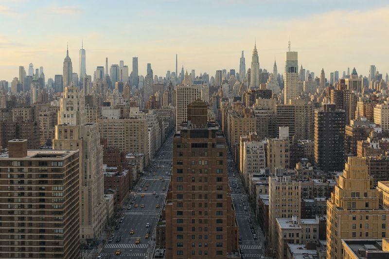
New York is the one large American city where the local advice is to park the car and use it as little as possible. That is not a criticism of the driving. It is a consequence of geography: Manhattan is an island reached by a countable number of bridges and tunnels, and the street pattern at the southern end of it was set down long before anyone owned a car.
None of which makes a car useless. A great many people drive into the five boroughs every day, parts of Queens, Brooklyn and Staten Island are genuinely car-dependent, and if you are arriving from more than a couple of hours out, driving is often the sensible way to do it. The skill is knowing the point at which the car stops helping.
What follows is the practical side — the approaches, the way tolling works now that it is entirely electronic, the timing that decides whether a crossing takes forty minutes or two hours — and then the parts of the city that reward putting the car down and walking.
The roads into New York City
Nearly every approach funnels into one of a small number of water crossings, and the crossing you choose matters more than the highway that delivered you to it.
From the south and west, the New Jersey Turnpike carries most of the load. Over a long stretch it splits into inner and outer roadways — cars to the left, trucks to the right, both rejoining later — which is a feature rather than a wrong turn. From there the options are the Holland Tunnel into Lower Manhattan, the Lincoln Tunnel into Midtown, or the George Washington Bridge into upper Manhattan and the Bronx.
From the north, the New York State Thruway becomes I-87 and runs down through Westchester into the Bronx as the Major Deegan Expressway. From New England, I-95 arrives as the New England Thruway. From Long Island, the Long Island Expressway runs west through Queens toward the Queens-Midtown Tunnel, and the Belt Parkway loops around the southern shore of Brooklyn.
The Cross Bronx Expressway deserves a specific warning. It is short, it is the only continuous east-west route through the borough, and it is reliably among the slowest stretches of interstate in the country. If your route offers an alternative, take the alternative even when it looks longer.
Tolls and how they are collected
Every crossing from New Jersey is tolled, as are most of the bridges and tunnels operated within the city. Collection is fully cashless. There is nothing to stop for on the main lanes: traffic passes under a gantry at speed and the charge is read from a transponder mounted on the windshield, or billed by mail against the license plate.
Two things follow from that. In a rental car, ask at the counter how tolls are handled and whether a transponder is already fitted, because the per-toll administrative fee is often larger than the toll. And note that several crossings are tolled in one direction only, so a route that looks symmetrical on the map may not cost the same coming back.
Manhattan additionally charges vehicles for entering the island below 60th Street, collected the same way and stacked on top of any crossing toll. The current rates and hours are published by the operating authority and do change, so check them rather than working from memory.
The parkways and the low-bridge problem
The parkways are not interchangeable with the expressways. They were built for passenger cars, they prohibit commercial vehicles outright, and several carry stone overpasses low enough that a box truck or a tall rental van will not clear them.
This is not a hypothetical. Trucks strike parkway bridges regularly, and the cause is almost always a driver following a route that had no idea how tall the vehicle was. If you are in anything larger than a car, set the vehicle height in your navigation and read the word “parkway” on a sign as an instruction.
Traffic and timing
The peaks here are long and the shoulders between them are thin. Inbound crossings load up from early morning and stay heavy into mid-morning. The outbound direction starts building mid-afternoon and does not really clear until evening. Fridays run to their own earlier schedule, and Sunday evening carries the whole weekend back from the beaches and the mountains at once.
Midday on a weekday is the calmest window for a crossing. Early on a weekend morning is better still. Overnight is genuinely quiet, with the caveat that maintenance closures on the bridges and tunnels are common at those hours and can wipe out the advantage.
Inside Manhattan, congestion is less about volume than friction. Delivery vehicles double-park by necessity, cross streets meter the avenues, construction takes a lane without notice, and pedestrians cross when it suits them. Average speeds in the core are low enough that walking is faster over short distances and the subway is faster over long ones.
Where to leave the car
This is the decision the whole visit turns on, and the honest answer for most drivers is: not in Manhattan.
Garages exist in quantity and are priced accordingly. Street parking is a layered system of metered blocks, permit-only zones, loading restrictions and alternate side rules that suspend parking on one side of the street on scheduled days for cleaning. Reading a New York parking sign correctly is a real skill, and the cost of misreading one is a ticket or a tow.
The move that works is a park-and-ride. Commuter rail and subway lines reach far out into New Jersey, Westchester, Long Island and the northern Bronx, and many stations have lots. Leave the car there, buy a ticket, and arrive in Midtown without having negotiated a garage ramp or a toll gantry.
If you are staying in an outer borough, apply the same logic at a smaller scale: park where you sleep and take the subway. And if you do drive into the core, park once for the whole day rather than relocating between neighborhoods, because moving the car means paying twice and sitting in traffic in between.
What is worth stopping for
Organized by where a single parking decision buys a whole day on foot.
Midtown
Almost everything people picture when they picture New York sits within about a mile of Grand Central Terminal: Times Square, Bryant Park and the main branch of the public library, the Empire State Building a few blocks south, Rockefeller Center and St. Patrick’s Cathedral to the north, and the Fifth Avenue shops in between. The Museum of Modern Art is in the middle of it.
This is simultaneously the worst area in the city to drive and the best to walk. Park at the edge of it, or arrive by train and do not park at all.
Lower Manhattan and the Brooklyn Bridge
The southern tip has the oldest street pattern in the city, narrow and angled and nothing like the grid that begins above Houston Street. Battery Park at the bottom is where the ferries to the Statue of Liberty and Ellis Island leave. The 9/11 Memorial and Museum, Trinity Church, the Stock Exchange and the South Street Seaport are all inside a walkable radius of one another.
From near City Hall you can walk across the Brooklyn Bridge on the elevated promenade above the traffic. It is one of the great city walks anywhere, it costs nothing, and it lands you in Brooklyn Heights and DUMBO with the skyline behind you.
Central Park and the museums
Central Park absorbs a full day without difficulty, and the two heavyweight collections sit on its flanks — the Metropolitan Museum of Art on the east side, the American Museum of Natural History on the west. Museum Mile continues north along Fifth Avenue with several more, including the Guggenheim in its spiral building.
There are garages in the blocks surrounding the park and some metered street parking on the side streets. One stop covers the park, a museum and a long walk between them.
Brooklyn, Queens and the beaches
The outer boroughs are where a car starts earning its keep again. Prospect Park, the Brooklyn Museum and the Botanic Garden cluster together with parking nearby. Coney Island sits at the end of the Belt Parkway with a beach, a boardwalk and actual lots. Queens has Flushing Meadows and a long run of distinct food neighborhoods, and the Rockaways offer ocean beaches inside the city limits.
If you are flying in or out, the Newark airport guide has drive times from around the region.
Using New York as a base
Point the car outward and it makes far more sense. The Hudson Valley begins within an hour north, with Bear Mountain, Cold Spring and the river estates. Long Island runs a hundred miles east to Montauk. The Jersey Shore is a straightforward run south, and Philadelphia is close enough for a day trip if you leave early. The other city driving guides cover several of those destinations from the other end.
The table below lists what is reachable within four hours’ driving, with estimated distances and times, so you can weigh a day trip before you commit to it.
Within four hours' drive of New York City
Places you can reach in a single sitting, with estimated road distance and drive time. Pick any row for the full route, including the towns you would pass.
| Destination | Distance | Drive time |
|---|---|---|
| Parsippany, NJ | 29 mi | 46 min |
| White Plains, NY | 31 mi | 49 min |
| New Brunswick, NJ | 34 mi | 54 min |
| Norwalk, CT | 49 mi | 58 min |
| Lakewood, NJ | 51 mi | 1 hr 1 min |
| Fairfield, CT | 56 mi | 1 hr 8 min |
| Toms River, NJ | 62 mi | 1 hr 14 min |
| Stratford, CT | 65 mi | 1 hr 18 min |
| West Haven, CT | 78 mi | 1 hr 34 min |
| New Haven, CT | 81 mi | 1 hr 37 min |