Driving in San Antonio, TX: the loops and where to park
8 min read
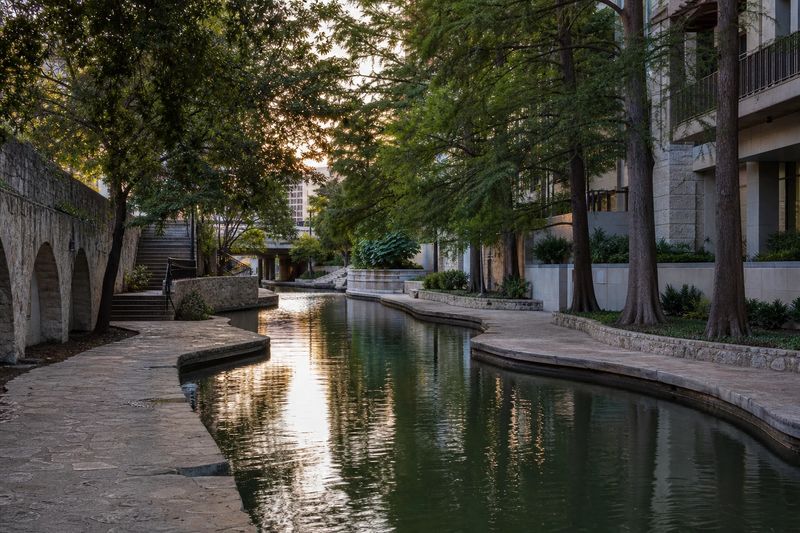
San Antonio is one of the ten largest cities in the United States and one of the easier ones to drive in. The freeway network is unusually generous for the population it serves, two complete ring roads let you get around almost any problem, and — unlike every other major Texas metro — there are no toll roads to think about. For a driver arriving from elsewhere, that combination removes most of the usual big-city friction.
What San Antonio has instead is a historic center laid out long before cars existed. The core is compact, dense, full of one-way streets, and built around a river that runs a level below the sidewalks. It is a wonderful place to walk and a mediocre place to drive around in circles looking for a space. The rest of the region is the opposite: spread thin across a lot of ground, with the missions strung out to the south, the museums scattered north, and the Hill Country starting less than an hour from the outer loop.
So the practical question is not really how to drive here. It is where to stop driving.
The roads into San Antonio
Four highways carry almost everything into the center, and they meet in a short and busy stretch just north and east of downtown.
I-35 is the spine, running northeast toward Austin and southwest toward Laredo and the border. It is the single most congested road in the region and one of the busiest freight corridors in the country, which means truck volume stays high outside the commuter peaks. I-10 crosses east to Houston and west toward El Paso, sharing alignment with I-35 for a short distance near the center. I-37 heads southeast toward Corpus Christi and the coast. US 281 runs north into the Hill Country and is the main approach from the airport.
Where those routes converge the interchanges come quickly, the signs give you less warning than you would like, and lane changes need to be made early. If you are not stopping downtown, do not drive through it.
The two loops
San Antonio’s ring roads are the most useful thing to understand about the region.
Loop 410 is the inner ring. It was the edge of the city once and is now well inside it, so it behaves less like a bypass than like a very fast arterial, with closely spaced exits and heavy local traffic on the northern side. Loop 1604 is the outer ring, further out through the newer suburbs, and it is generally the quicker way to cross from one side of the region to the other.
The rule of thumb: if San Antonio is your destination, take the freeways in. If San Antonio is in your way, take Loop 1604 around. Crossing the whole metro on the outer loop is frequently faster than the shorter line through the middle, and it avoids the downtown interchanges entirely.
Tolls, or the absence of them
There is not much to explain here, and that is the point. The San Antonio area has no toll roads. You can cross the region in any direction on free freeways, without a transponder and without a bill turning up weeks later.
This is worth registering if San Antonio is one stop on a longer Texas trip, because Austin, Dallas, Fort Worth and Houston all run electronic tolling, and rental companies add their own administrative fee on top of each individual charge. Ask at the counter how tolls are handled before you drive off, then enjoy the fact that none of it applies while you are here.
When the traffic actually builds
The commuter peaks run roughly seven to nine in the morning and four to six thirty in the afternoon. I-35 through the center takes the worst of it, along with the northern approaches to both loops, where the newest and fastest-growing suburbs sit.
San Antonio has one pattern that catches visitors out. Several large military installations are spread around the region, and they generate substantial commutes on their own schedules, which start earlier than the civilian rush and end earlier too. On the mornings when both patterns overlap, the freeways near those bases fill up before seven.
The other calendar item worth knowing is that the city holds a major festival in late April that closes central streets for parades over several days. If your dates fall in that window, check the closures before you plan a downtown parking stop.
Weather that affects the driving
Two things shape driving conditions locally. The first is heat: summer afternoons are long and severe, and a car left in the open all day in July is genuinely unpleasant to get back into. Shaded or structured parking is worth more here than in most cities.
The second is water. San Antonio sits where the Hill Country meets the plain, and rain falling on thin soil over limestone runs off fast. Creek crossings that are dry for months can fill within minutes of a storm upstream. Low water crossings are signed, and the local convention is absolute: you do not drive into moving water. Storms here are usually short, so waiting costs you very little.
Where to leave the car
Downtown is the decision that matters. The historic core is small — you can cross the whole of it on foot in twenty minutes — and it contains most of what people come to see. Park once, in a structure, and walk.
Garages are plentiful within a few blocks of Alamo Plaza and the river, and the difference between one directly beside your first stop and one four blocks away is usually not worth paying for, because everything is within four blocks of everything else. Street parking is metered, time-limited and enforced.
North of downtown, the former brewery complex that now anchors the Museum Reach of the river has its own parking and works as a second park-once base, with a riverside walk connecting it back to the center. South of downtown, the missions each have their own lot, so that stretch genuinely does want a car.
For events, the large venues east and south of the center have their own lots, and using one of them is almost always better than circling the streets nearby.
One more thing about the historic core: it is full of one-way streets, and several of them change direction or terminate in ways the map does not make obvious until you are committed. Take the turn you are told to take. Circling back around a block downtown here is a longer operation than it looks, particularly with the river cutting across the pattern below street level.
The two large amusement parks on the western and northwestern edges of the region both have their own extensive parking, and both generate heavy traffic on their access roads in the late morning and again at closing time. If your route uses those corridors in summer, allow for it.
What is worth stopping for
Organized by where one parking stop gets you several things on foot.
The downtown core
The Alamo sits on a plaza in the middle of the business district, which surprises first-time visitors who expect it somewhere remote. The River Walk begins a block away and runs below street level through the center, lined with stone footbridges and cypress trees, and it is the reason the city feels different from other Texas downtowns.
Within the same walk: La Villita, a preserved block of early buildings above the river; Hemisfair, the park left behind by the 1968 world’s fair, with the observation tower still standing at its center; and Market Square on the western edge, a covered market complex that has been trading in the same spot for generations. One garage covers all of it.
The missions
Four Spanish colonial missions stand in a rough line along the river south of downtown, and together with the Alamo they form a World Heritage listing. They are working churches as well as historic sites, and they are far better preserved than most visitors expect.
The drive south is signed and simple, with parking at each. The alternative is the hike-and-bike trail along the restored southern stretch of the river, which connects them without a car at all. Either way, allow most of a morning.
North of the center
Brackenridge Park holds a cluster of attractions inside a short walk of one another, including a sunken garden built into an old quarry and a natural history museum on the riverbank. Further out on the northeast side there is a fine art museum on a former estate, with grounds worth the walk on their own.
The residential district immediately south of downtown, with its nineteenth-century houses, is one of the better neighborhoods in Texas to wander through with no particular plan. It runs into a small commercial strip on its southern side, so one parking stop covers both, and the river walk extends down that way from the center if you would rather approach on foot.
A note on driving times inside the region
Distances between the north side and downtown look short on a map and are not. The built-up area extends well past the outer loop in every direction except the south, and a trip from a hotel near the northern suburbs to a garage downtown is a real twenty-five to thirty minutes outside the peaks and considerably more inside them. If you are working out whether two things fit into one day, the distance calculator is a faster way to check than guessing from the map.
Using San Antonio as a base
This is where the car earns back its keep. Austin is a short run northeast, close enough that people commute. The Hill Country begins within half an hour of the northern suburbs and delivers two-lane roads, spring-fed swimming holes, caverns and small towns founded by German settlers. The Gulf coast is a straightforward drive southeast, and Houston is a comfortable half day east on I-10, with the Texas coastal plain flattening out the whole way.
The table below lists what is reachable within four hours’ driving, with estimated distances and times, so you can weigh a day trip before you commit to it.
Within four hours' drive of San Antonio
Places you can reach in a single sitting, with estimated road distance and drive time. Pick any row for the full route, including the towns you would pass.
| Destination | Distance | Drive time |
|---|---|---|
| New Braunfels, TX | 36 mi | 57 min |
| San Marcos, TX | 53 mi | 1 hr 4 min |
| Pflugerville, TX | 102 mi | 2 hr 2 min |
| Victoria, TX | 116 mi | 2 hr 19 min |
| Killeen, TX | 146 mi | 2 hr 26 min |
| Corpus Christi, TX | 151 mi | 2 hr 31 min |
| Temple, TX | 156 mi | 2 hr 36 min |
| Laredo, TX | 169 mi | 2 hr 49 min |
| Bryan, TX | 178 mi | 2 hr 58 min |
| Waco, TX | 194 mi | 3 hr 14 min |